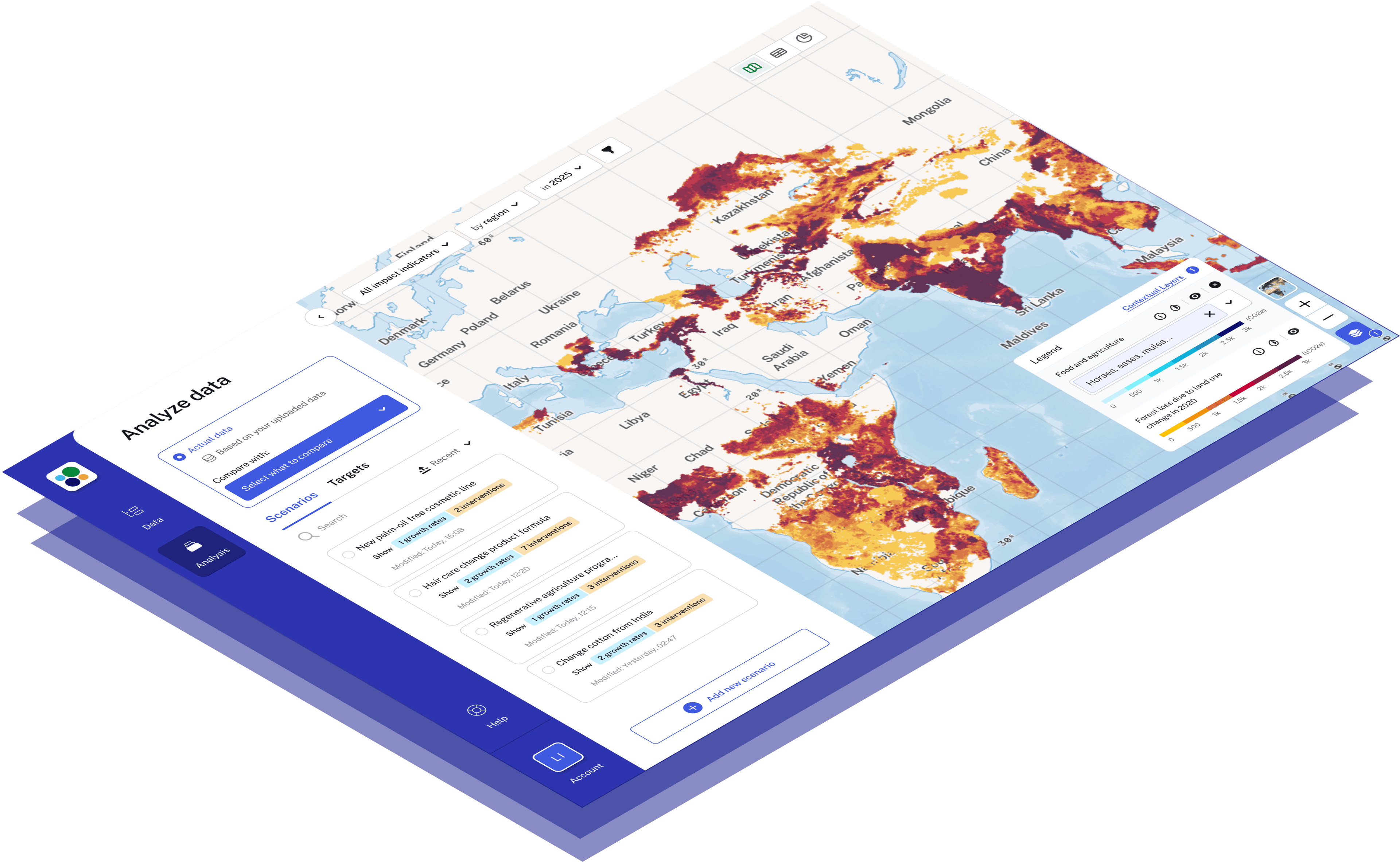
Analyze impacts with world-renowned datasets.
Our open-source and open-science software ensures total transparency to align companies with nature standards and ESG regulations, such as SBTN and TNFD guidance.

5 New, Open-Access Datasets
for carbon and nature
accounting.
Data aligned with SBTN,
TNFD and GHG Protocol.
Prepare for regulations.
We are participating in the SBTN & TNFD process to ensure our data analysis meets their regulations and guidance.

- The Science Based Targets Network gives companies and cities a clear pathway to competitiveness and resilience by using science to define their role in restoring nature.
- The Taskforce on Nature-related Financial Disclosures develops and delivers a risk management and disclosure framework for organisations to report and act on evolving nature-related risks.
LandGriffon supports you in meeting your Climate, Nature and SDG targets:
Want to know more about how we can help you align with emerging nature standards and regulations? Contact us
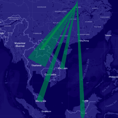
Our spatial sourcing model.
Nature metrics need spatial information. Regardless of how much data you have on your supply chain, LandGriffon is built for you.
Our sourcing model maps supply chains using a combination of the information you provide, gridded crop production, and international trade data.
LandGriffon combines these maps with satellite-based and spatial data sources to calculate impacts. The method is the same for globally sourced commodities or exact farm locations, meaning our single tool will cater for an entire supply chain and its range of sourcing information.
Sourcing location time
Modeled likely production areas
Aggregation point
Produced within 50km of this location
Producer country or jurisdiction
Produced within this country or jurisdiction.
Delivery country
Produced within or imported to this country.
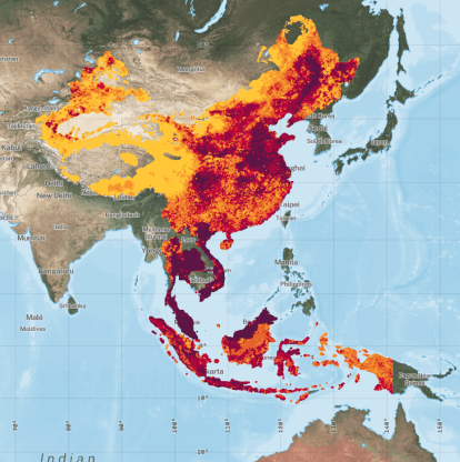
BUILT ON TRUSTED SCIENTIFIC DATA.
Landgriffon is built on open-access data produced by leading researchers, NGOs, and government programs such as Copernicus, making it easier for you to take advantage of this scientific knowledge.
Forest loss & Land Carbon:
Cropland & Yields:

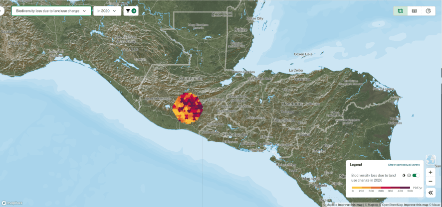
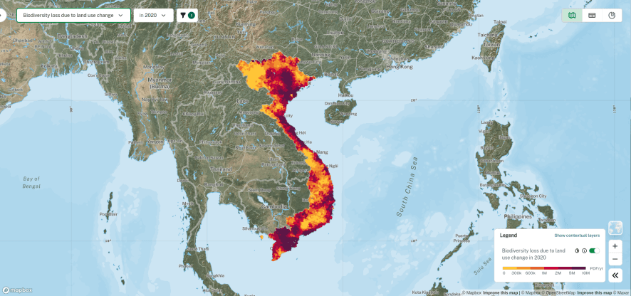
Biodiversity:

Water:
LandGriffon is designed to meet your needs
Measure water, land, deforestation, and biodiversity with included open data sources.
Bring in any data source or API: spatial, non-spatial, financial, social, or otherwise.
Work with us to design custom metrics to meet specific needs or targets.
Open source & open science.
Our service is built on the foundations of trust and transparency, only possible through open-source development and an open-science methodology.
It is important that the methods used to evaluate company performance are transparent and verifiable. Through maximising intellectual access, we hope to maximise change.
Share your thoughts
Our methodology has been validated by Satelligence, the Stockholm Environment Institute and their Trase initiative. We are keen to collaborate with the wider research and policy community towards a common goal of supply chain sustainability.
If you have any feedback or if we can be of help: Contact us now